

We’ve put together this list of Top 10 drone apps for drone pilots. Whatever new drone photography skill you want to learn, there’s an app for it . These apps work for Mavic Pro and Mavic Mini, amongst many others. There are a lot of drone apps, in fact, and it’s hard to know which one to choose.
Quadcopter FX Simulator
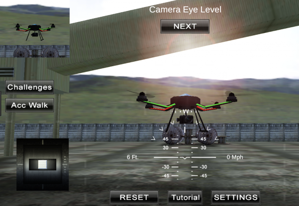
There are lots of apps available that claim to be drone simulators, but few of them are any good at simulating the real experience. Quadcopter FX Simulator is one of the Top 10 drone apps for drone pilots , because it does a very nice job of reproducing the feel and experience of flying a drone.
You get access to a number of viewpoints — including the ground — plus a normal camera on the drone and a stabilized gimbal.The controls can be customized and tweaked a lot, and models of a number of different sizes and types of drone are included.
If you pay $4.99 for the pro version, you get more flying locations and even more customization. Unlike the real thing, however, in this app, you just press a button to return to your takeoff point and repair your drone. The latest version also adds support for Google Cardboard VR for more immersive flying.
[amazon bestseller=”drones with camera” items=”3″ grid=”3″]
Sun Surveyor drone app
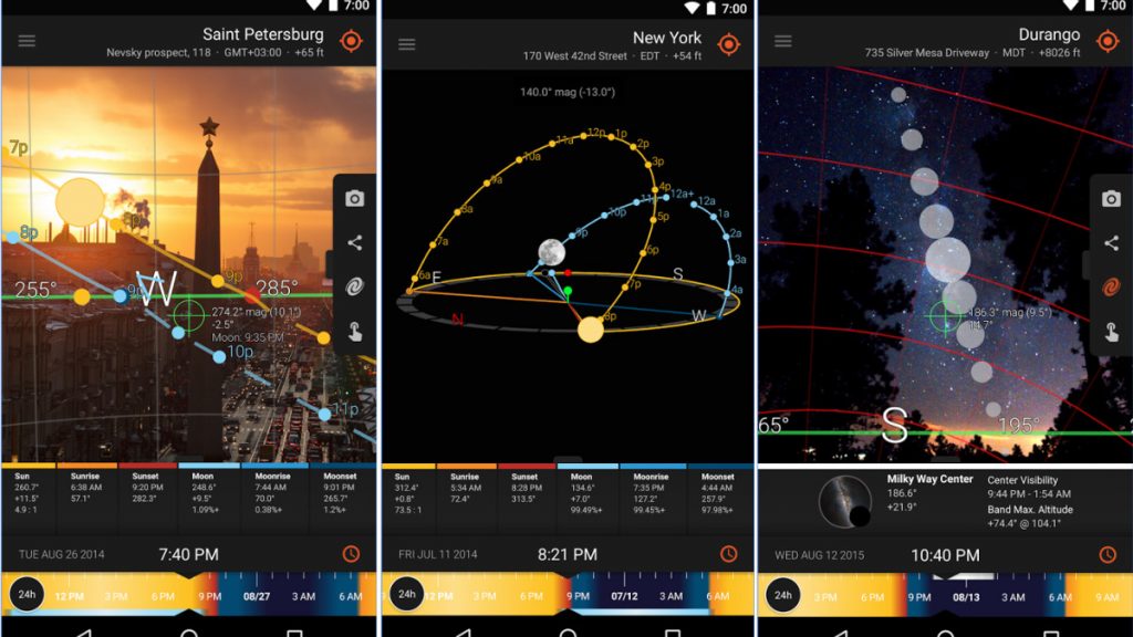
Planning to take a video of a dramatic sunset? Sun Surveyor can help you make sure you get the shot. Working from a map, the app will show you the path of the sun and moon, including precise times for sunrise, sunset and the lunar equivalents over the entire year.
If you are at the location, Sun Surveyor will even show you the path that the sun and moon will take in the sky by overlaying it on the camera view, enabling you to scout a location for the perfect shot.
It can even use Google Street view data to show you a preview of how the sun might rise over buildings. The full version costs $7.99, but offers notifications for upcoming photo opportunities like full moon, moon rise and other interesting stuff in the sky.
[amazon bestseller=”dji drone” items=”3″ grid=”3″]
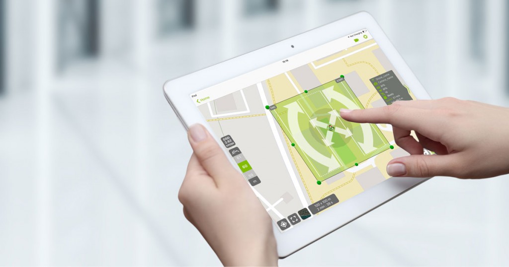
DJI Ground Station Pro
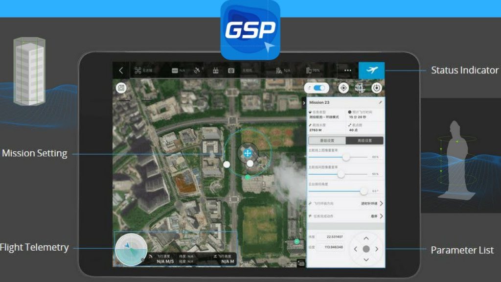
DJI offers this app for serious and professional drone users who want to create complex autonomous flight paths. It’s designed to make the process of creating these paths easier by automating it. It is one of the Top 10 drone apps for drone pilots fllying DJI drones.
The user selects an area on the map that he or she wants to survey, and the app automatically creates a flight path that covers the entire area, giving you the ability to adjust the amount of detail that is needed.If you just want a quick, rough overview, Ground Station Pro will do a few passes.
If you want much more detailed images (for building a 3D model or for surveying the land), it will create a path with more passes that provides the multiple views that the enhanced detail needs.
[amazon bestseller=”yuneec drone” items=”3″ grid=”3″]
GoPro Passenger drone app
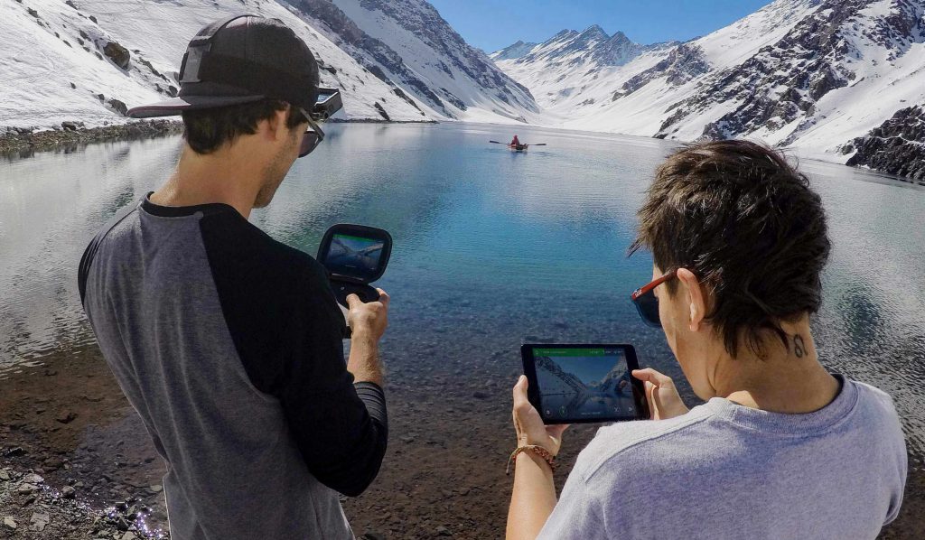
Although GoPro’s Karma drone never really got off the ground (the company is selling off the remaining inventory, but still supporting the drone), but if you know someone who has one, you’ll be able to grab a neat app called Passenger, which allows a second user to view the wireless video from the camera that’s attached to the drone.
The second user will also be able to control the camera, panning and tilting it around as the pilot controls the drone itself. In effect, that person will be able to work as the camera operator while the pilot keeps the drone flying.
[amazon bestseller=”dji mavic drone” items=”3″ grid=”3″]
Pix4D Capture drone app
Photogrammetry is the process of creating a 3D model from a 2D image, such as a drone video. That’s what Pix4D Capture does:
This app automatically creates a flight path for your drone (models from DJI, 3DR and Parrot are supported), then uploads the video and flight data to the Pix4D servers.
You can then use these servers or your desktop PC to crunch through this data, turning the images and location of the drone into a 3D model of whatever you were flying over.
The full service isn’t cheap ($499 for a year’s subscription of unlimited model making), but Pix4D does offer a 15-day trial that will allow you to try out the service.
[amazon bestseller=”drones with camera” items=”3″ grid=”3″]
Sky Viper Simulator
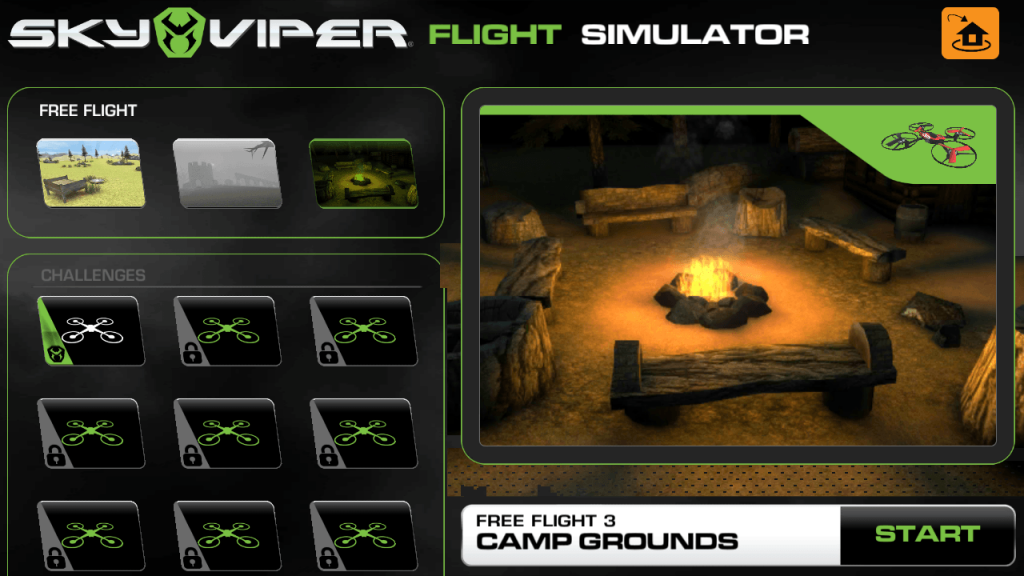
We liked the Sky Viper Hover Racer when we reviewed it, but you don’t need to buy the drone to try it out.
The Sky Viper simulator offers simulated flights with their entire range of drones from the tiny nano to the nippy Hover Racer.
For each of the drones, you can fly freely to practice, or on a variety of timed circuits that test you skill.
It’s a fun way to get some flying practice with a range of drones, and you can recover from a crash with a press of a button.
[amazon bestseller=”drones with camera 4k” items=”3″ grid=”3″]
Hover drone app
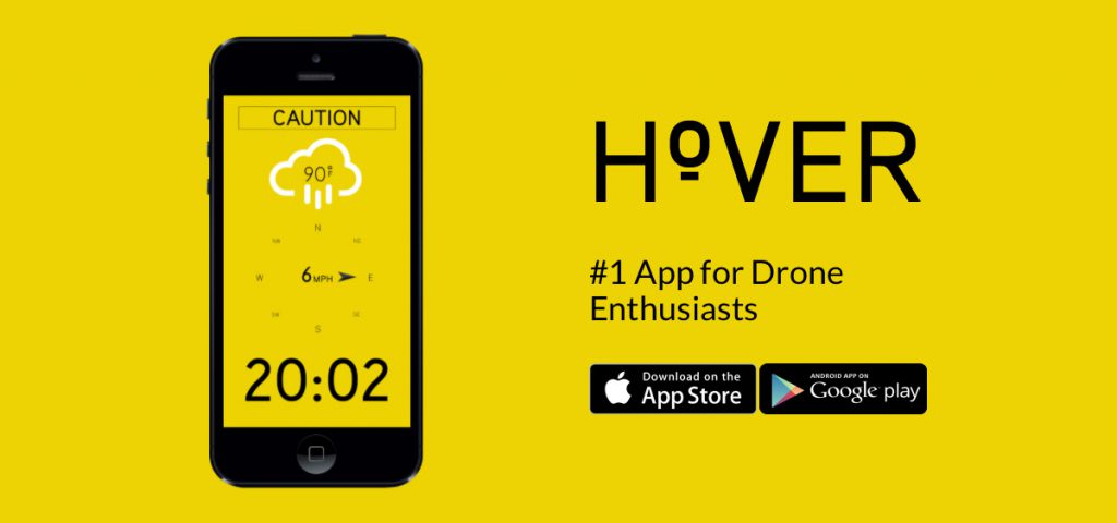
Flying a drone requires two things: good weather and a spot from which to take off. Hover helps you find both by providing a simple fly/no fly indication, based on live weather updates and a database of no-fly zones.
At a glance, it indicates whether your location is a good one and if the weather is suitable for takeoff. The app also provides details of how the weather is going to change over the next few hours, which is useful for figuring out if you should fly now or later.
It’s a simple app that every drone pilot should have, and it also includes a simple flight log that helps you track your flying hours.
[amazon bestseller=”potensic drones” items=”3″ grid=”3″]
Airmap, A must have every drone pilot
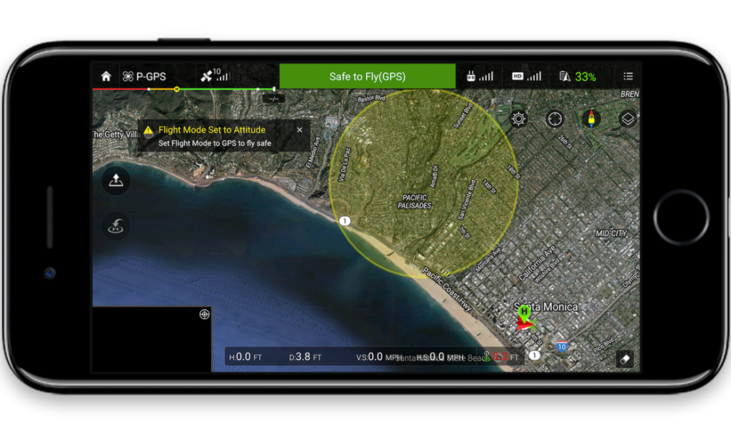
A must-have for every drone pilot. Whether you’re a commercial or recreational drone photographer, AirMap will have the right features for you.
Some of the more advanced features include drone mapping, geo-fencing and flight logging. Even if you’re a beginner and have no use for them, the app’s location-based flight restriction info is vital for everyone with a drone.
AirMap has information about UAV laws in over 20 countries. This is especially useful for drone photographers who like to travel.
AirMap can also be set to control DJI drones, allowing pilots to map out flight paths and control their drone from inside the app.
B4UFly drone app
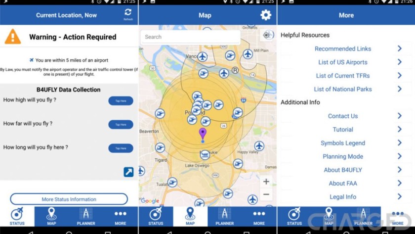
If you live in the United States, you’ll want to make sure you’re following Federal Aviation Administration (FAA) regulations.
B4UFly is the app the FAA has produced to make it super simple to know where in the US you can and can’t fly your drone.
It includes a detailed listing of every airport in the country and a 5-mile radius around each one.


